Gravity and Magnetic: Basics and Applications
About Course
Gravity and magnetic methods offer a cost-effective approach to mapping subsurface geology and structures. This module covers the fundamentals of gravity and magnetic techniques, including data acquisition, processing, and interpretation. The application of these methods to address geological and geotechnical problems is also discussed.
Period:
• Six weeks (condensed module)
• Twelve weeks (full module)
Contents:
• Magnetic Method:
• Magnetic field
o Magnetic poles, flux, force, induction, field strength, and permeability
o Hysteresis Curve
• Induced and remnant magnetization
• Magnetic susceptibility (Diamagnetic, Paramagnetic, Ferromagnetic, and Ferrimagnetic)
• Origin and Elements of Earth’s Magnetic Field
o Geographic and Magnetic axis, meridian, and equator
o Declination and Inclination
o International Geomagnetic Reference Field (IGRF)
• Resonance Magnetometers (Proton free-precession, Alkali vapor)
• Field magnetic survey
o Survey types & procedures
o Noise and Corrections (Diurnal correction)
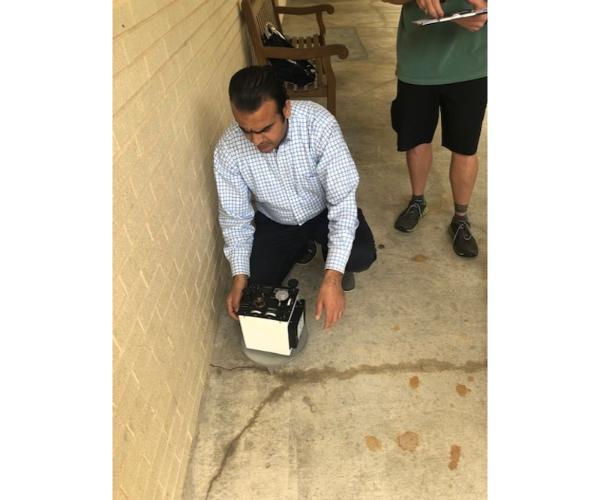
• Field acquisition of magnetic data (Geometrics G-858 magnetometer)
• Processing for field magnetic data (Geosoft Oasis Montaj software)
o Reduction to the pole (RTP)
o Forward and Inverse Modeling
o Depth Estimation
o Reginal and residual anomalies
o Upward and downward continuations
o Field derivatives, Euler’s Deconvolution, and Analytic signal
• Interpretation of magnetic data
o Qualitative and quantitative
• Applications of geomagnetic methods
• Case studies of geomagnetic methods
• Gravity Method:
• Gravity Field
• Newton Laws
• Gravitational Acceleration
• Theoretical Sea Level Gravity (TSLG)
• Densities of Rocks and Minerals
• Gravimeters (relative and absolute)
• Field gravity survey
o Survey types & procedures
• Field acquisition of gravity data (LaCoste & Romberg gravimeter)
• Reduction for Field gravity data
o Drift Correction
o Tide Correction
o Latitude Correction
o Free-air Correction
o Bouguer Correction
o Terrain Correction
o Eotvos Correction
• Gravity anomalies
o Free-air anomaly
o Simple Bouguer anomaly
o Complete Bouguer anomaly
• Density determination techniques
• Processing for Field gravity data (Geosoft Oasis Montaj software)
o Forward and Inverse Modeling
o Depth Estimation
o Reginal and residual anomalies
o Upward and downward continuations
o Field derivatives, Euler’s Deconvolution, and Analytic signal
• Interpretation of gravity data
o Qualitative and quantitative
• Applications of gravity method
• Case studies of gravity method
Participants will develop field and software-oriented skills on how to:
• Conduct gravity and magnetic surveys in the field.
• Process and visualize gravity and magnetic data.
• Interpret gravity and magnetic data.
• Use gravity and magnetic data to address different geological and geotechnical problems.
Student Ratings & Reviews
No Review Yet
Details
- category
- October 22, 2024 Last Updated