OUR SERVICES
Global Geosolutions LLC is committed to providing innovative and comprehensive solutions in environmental, geological and hydrogeological, geotechnical, and geospatial fields.


Soil & Water Quality Assessment
- Soil contamination profiling and mapping
- Surface water quality assessment and monitoring
- Groundwater quality assessment and monitoring
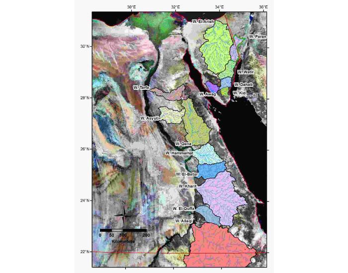
- Watershed assessments
- Land use/land cover changes
- Floodplain and flood hazard mapping
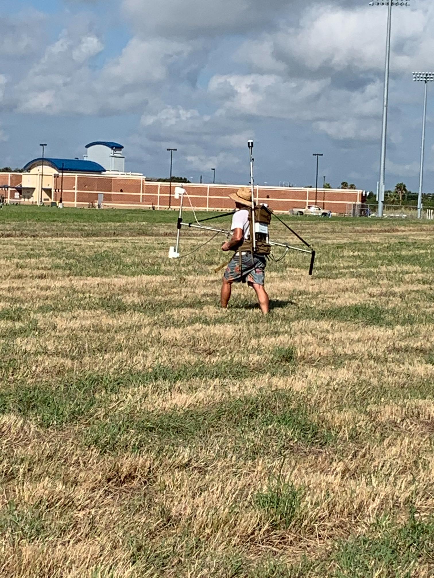
Subsurface Applications
- Subsurface contaminant plume mapping
- Mapping optimal locations for landfills
- Leachate detection from landfills
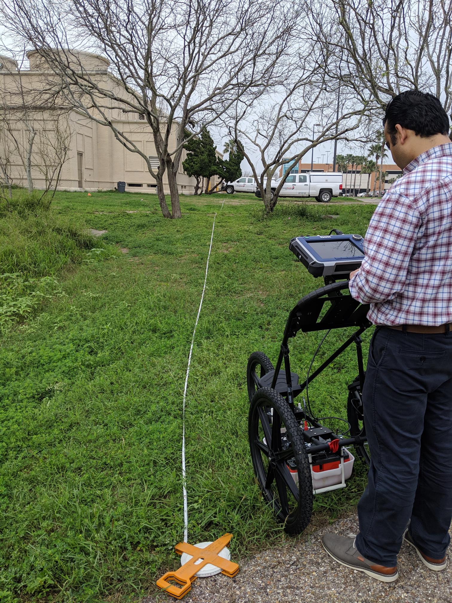
- Utility and storage tank detection
- Sinkhole, cavities, and void detection
Regulatory Reporting & Expert Support
- Environmental impact assessments and Environmental Impact Statements
- Technical documentation for permitting and enforcement actions
Environmental
Environmental
Soil & Water Quality Assessment
- Soil contamination profiling and mapping
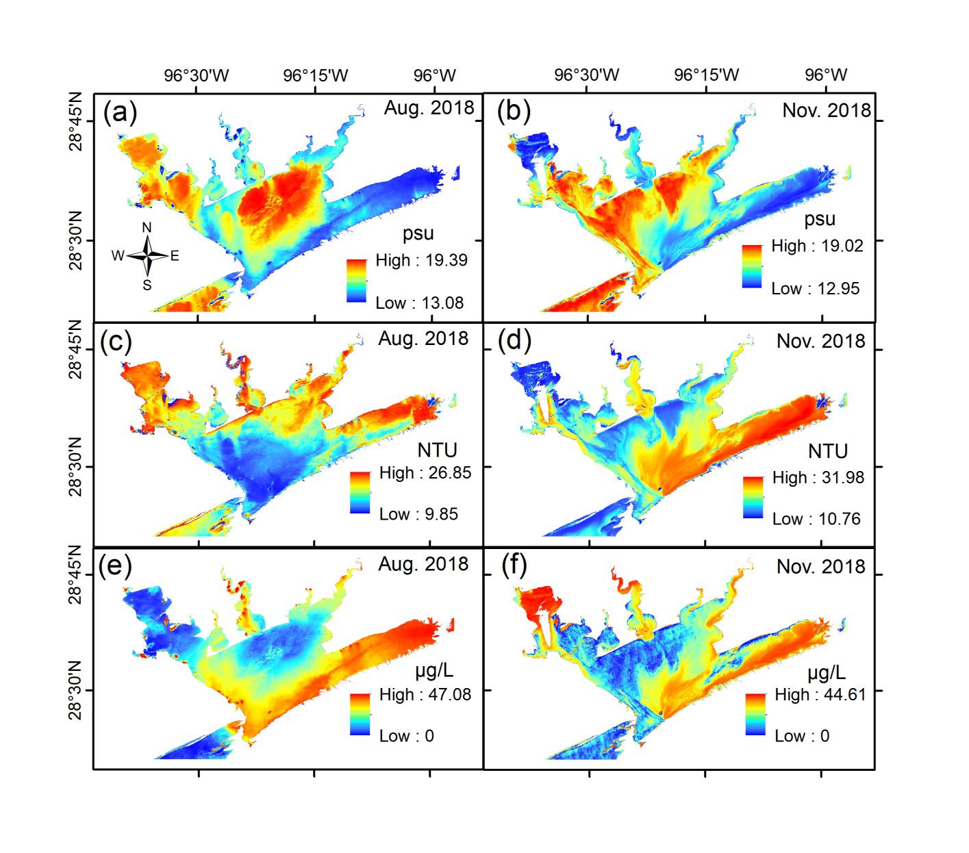
- Surface water quality assessment and monitoring
- Groundwater quality assessment and monitoring
- Watershed assessments
- Land use/land cover changes
- Floodplain and flood hazard mapping
Subsurface Applications
- Subsurface contaminant plume mapping
- Mapping optimal locations for landfills
- Leachate detection from landfills
- Utility and storage tank detection
- Sinkhole, cavities, and void detection
Regulatory Reporting & Expert Support
- Environmental impact assessments and Environmental Impact Statements
- Technical documentation for permitting and enforcement actions
Geotechnical
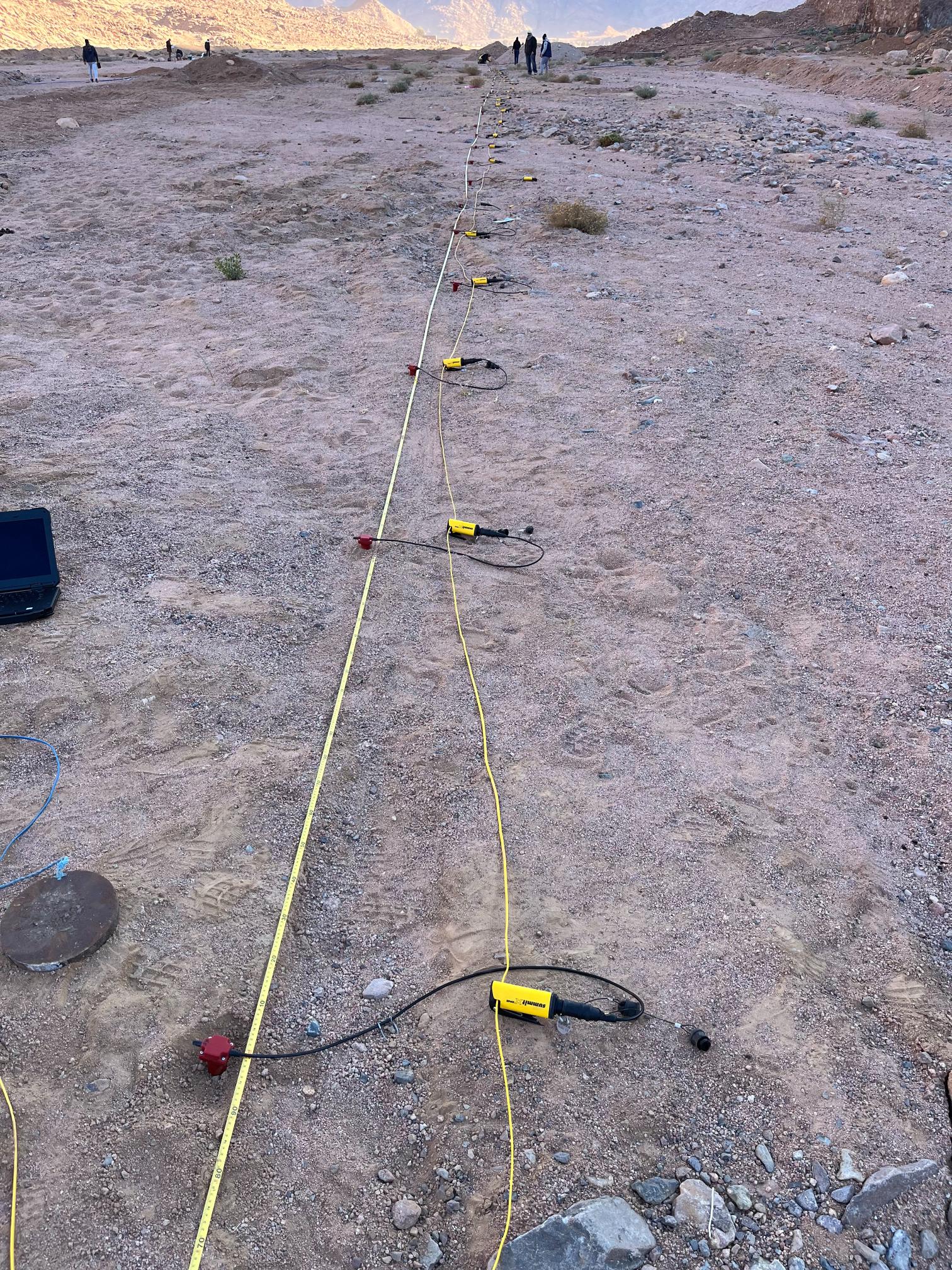
Subsurface Characterization & Stratigraphy
- Mapping depth to bedrock and soil thickness
- Mapping lithology and fluid contents
- Mapping subsurface clay and sand lenses
- Mapping thickness of water-bearing layers
Structural & Geohazard Mapping
- Mapping sinkholes, voids, and cavities
- Mapping surface and subsurface faults and fractures
- Mapping subsurface weakness zones
- Mapping and monitoring land subsidence
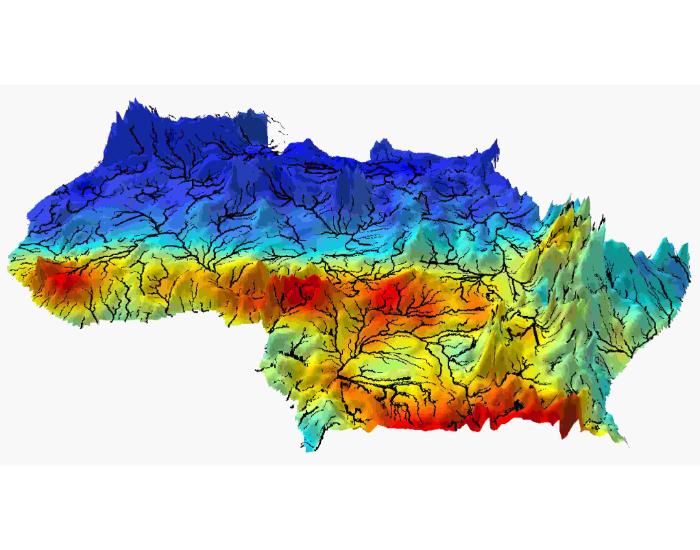
Hydrogeological Mapping
- Mapping groundwater levels
- Mapping groundwater flow directions
Infrastructure & Utility Detection
- Mapping subsurface utilities (tanks, pipes, sewers, cables, drums, etc.)
- Mapping leaks from subsurface utilities
Data Integration & Decision Support
- Geotechnical database development and management
- Technical reviews for geotechnical related studies
Geotechnical
Subsurface Characterization & Stratigraphy
- Mapping depth to bedrock and soil thickness
- Mapping lithology and fluid contents
- Mapping subsurface clay and sand lenses
- Mapping thickness of water-bearing layers
Structural & Geohazard Mapping
- Mapping sinkholes, voids, and cavities
- Mapping surface and subsurface faults and fractures
- Mapping subsurface weakness zones
- Mapping and monitoring land subsidence
Hydrogeological Mapping
- Mapping groundwater levels
- Mapping groundwater flow directions
Infrastructure & Utility Detection
- Mapping subsurface utilities (tanks, pipes, sewers, cables, drums, etc.)
- Mapping leaks from subsurface utilities
Data Integration & Decision Support
- Geotechnical database development and management
- Technical reviews for geotechnical related studies
Geological Site Investigations
- Soil, rock, and groundwater sampling, testing, and analysis
- Surface and subsurface structural mapping
- Identification and classification of surface and subsurface rock/sediment types
Geological Hazard Assessment
- Mapping of surface and subsurface faults
- Identification and risk mitigation strategies for karst features and sinkholes
- Geomorphological studies and flood risk evaluations
Contaminant Assessment
- Identifying and characterizing contaminant plumes (e.g., heavy metals, hydrocarbons, pesticides)
- Geological investigations for landfill design, siting, and monitoring
- Assessing risks of contamination and subsurface migration in water resources
Geotechnical & Geological Risk Management
- Creating 3D models of subsurface structures, stratigraphy, and groundwater flow
- Identifying risks from floods, landslides, and other geological phenomena
- Investigating and determining the causes of geological failures (e.g., sinkholes, foundation failures)
- Providing expert geological opinions and analysis for legal cases
Environmental Impact Assessments (EIA) & Permitting
Assessing the geological impacts of proposed construction and industrial activities
Proposing methods to mitigate adverse geological impacts (e.g., groundwater protection)
Geological
Geological
Geological Site Investigations
- Soil, rock, and groundwater sampling, testing, and analysis
- Surface and subsurface structural mapping
- Identification and classification of surface and subsurface rock/sediment types
Geological Hazard Assessment
- Mapping of surface and subsurface faults
- Identification and risk mitigation strategies for karst features and sinkholes
- Geomorphological studies and flood risk evaluations
Contaminant Assessment
- Identifying and characterizing contaminant plumes (e.g., heavy metals, hydrocarbons, pesticides)
- Geological investigations for landfill design, siting, and monitoring
- Assessing risks of contamination and subsurface migration in water resources
Geotechnical & Geological Risk Management
- Creating 3D models of subsurface structures, stratigraphy, and groundwater flow
- Identifying risks from floods, landslides, and other geological phenomena
- Investigating and determining the causes of geological failures (e.g., sinkholes, foundation failures)
- Providing expert geological opinions and analysis for legal cases
Environmental Impact Assessments (EIA) & Permitting
Assessing the geological impacts of proposed construction and industrial activities
Proposing methods to mitigate adverse geological impacts (e.g., groundwater protection)
Hydrogeological
Groundwater Characterization
- Mapping aquifer recharge and discharge locations
- Mapping spatial and temporal variations in groundwater levels
- Mapping thickness and hydraulic properties of water-bearing layers
- Mapping volume of groundwater in storage
- Mapping optimal locations for production, monitoring, and injection wells
- Mapping groundwater flow directions
- Mapping the aquifer response to climate changes and anthropogenic drivers
Quantitative Hydrogeologic Analysis
- Quantifying recharge and discharge rates
- Quantifying groundwater ages
- Quantifying aquifer longevity
- Watershed and Water budget analysis
Groundwater Quality & Contamination
- Mapping saltwater intrusion
- Mapping contaminant plumes
Geohazards & Overextraction Effects
- Characterizing and modeling land subsidence related to overextraction
- Groundwater sustainability assessments
Data Integration & Decision Support
- Groundwater level and quality spatial database development and management
- Technical reviews for groundwater-related studies
Geographic Information Systems (GIS) Services
- Creation of spatial maps for environmental, geological, and infrastructure projects
- Storing, organizing, and managing large datasets from various sources
- Presenting complex data in accessible, interactive maps
- Analyzing spatial patterns and trends, such as groundwater flow, land use, and environmental hazards
- Creating and managing geodatabases for storing and querying spatial data efficiently
Remote Sensing & Aerial Imaging
- Interpreting high-resolution satellite images for environmental applications
- Detecting temperature variations to identify subsurface anomalies, leaks, or areas of groundwater contamination
- Monitoring land or environmental changes over time, such as urban expansion, deforestation, or soil erosion
Spatial Modeling & Simulation
- Creating models of groundwater flow, surface water, and stormwater systems to assess water availability, contamination, and flood risks
- Using spatial data to model and assess the potential environmental impact of projects
- Modeling urban growth, agricultural expansion, and environmental degradation using spatial data
- Using spatial data to model the spread of contaminants in soil or groundwater over time
3D & 4D Spatial Analysis
- Creating 3D models of geological formations, subsurface structures, and mineral deposits
- Using temporal GIS analysis to visualize changes in environmental parameters, groundwater levels, or land movement over time
- 3D visualization of subsurface structures using geophysical data
- 3D models for construction and development projects, including site planning and hazard mitigation
Environmental Monitoring & Site Surveillance
- Monitoring environmental changes such as land deformation, habitat loss, or land degradation using remote sensing and GIS
- Tracking water and soil pollution across various scales, integrating remote sensing data and ground-based measurements
- Using spatial data to model flood zones, inundation areas, and potential flood risks based on hydrological conditions
- Using spatial data to assess and monitor soil erosion and sediment movement in watersheds or construction sites
Geospatial Data Integration & Custom Solutions
- Combining data from GIS, remote sensing, geophysical surveys, and field measurements for comprehensive spatial analysis
- Providing expert interpretation of spatial data for reports, presentations, or decision-making processes
- Developing custom GIS tools or applications to meet specific project or client needs
- Building and maintaining spatial databases tailored to the client's needs, such as water resources, environmental monitoring, or infrastructure management
Mapping Services, Decision Support & Spatial Planning
- Designing and producing thematic maps for presentations, reports, or field use
- Developing interactive, web-based mapping platforms for real-time data visualization, monitoring, and public engagement
- Producing topographic maps with contour lines for project planning and analysis, especially in construction or environmental management
- Using spatial analysis to assess optimal sites for projects such as landfills, renewable energy installations, or urban development
- Analyzing spatial data to predict and plan for climate change impacts, including sea-level rise, temperature change, and ecosystem shifts
- Using spatial data to inform environmental sustainability practices, such as habitat preservation, resource management, and land-use planning
Geospatial
Geospatial
Geographic Information Systems (GIS) Services
- Creation of spatial maps for environmental, geological, and infrastructure projects
- Storing, organizing, and managing large datasets from various sources
- Presenting complex data in accessible, interactive maps
- Analyzing spatial patterns and trends, such as groundwater flow, land use, and environmental hazards
- Creating and managing geodatabases for storing and querying spatial data efficiently
Remote Sensing & Aerial Imaging
- Interpreting high-resolution satellite images for environmental applications
- Detecting temperature variations to identify subsurface anomalies, leaks, or areas of groundwater contamination
- Monitoring land or environmental changes over time, such as urban expansion, deforestation, or soil erosion
Spatial Modeling & Simulation
- Creating models of groundwater flow, surface water, and stormwater systems to assess water availability, contamination, and flood risks
- Using spatial data to model and assess the potential environmental impact of projects
- Modeling urban growth, agricultural expansion, and environmental degradation using spatial data
- Using spatial data to model the spread of contaminants in soil or groundwater over time
3D & 4D Spatial Analysis
- Creating 3D models of geological formations, subsurface structures, and mineral deposits
- Using temporal GIS analysis to visualize changes in environmental parameters, groundwater levels, or land movement over time
- 3D visualization of subsurface structures using geophysical data
- 3D models for construction and development projects, including site planning and hazard mitigation
Environmental Monitoring & Site Surveillance
- Monitoring environmental changes such as land deformation, habitat loss, or land degradation using remote sensing and GIS
- Tracking water and soil pollution across various scales, integrating remote sensing data and ground-based measurements
- Using spatial data to model flood zones, inundation areas, and potential flood risks based on hydrological conditions
- Using spatial data to assess and monitor soil erosion and sediment movement in watersheds or construction sites
Geospatial Data Integration & Custom Solutions
- Combining data from GIS, remote sensing, geophysical surveys, and field measurements for comprehensive spatial analysis
- Providing expert interpretation of spatial data for reports, presentations, or decision-making processes
- Developing custom GIS tools or applications to meet specific project or client needs
- Building and maintaining spatial databases tailored to the client's needs, such as water resources, environmental monitoring, or infrastructure management
Mapping Services, Decision Support & Spatial Planning
- Designing and producing thematic maps for presentations, reports, or field use
- Developing interactive, web-based mapping platforms for real-time data visualization, monitoring, and public engagement
- Producing topographic maps with contour lines for project planning and analysis, especially in construction or environmental management
- Using spatial analysis to assess optimal sites for projects such as landfills, renewable energy installations, or urban development
- Analyzing spatial data to predict and plan for climate change impacts, including sea-level rise, temperature change, and ecosystem shifts
- Using spatial data to inform environmental sustainability practices, such as habitat preservation, resource management, and land-use planning
Do You Have any Questions?
NEED
CONSULTATION?
Contact us & ask your question
LATEST PROJECTS